From Space to Settlement
In South Sudan, satellite estimates reveal socioeconomic conditions falling in the years between household surveys
Sep 14, 2026
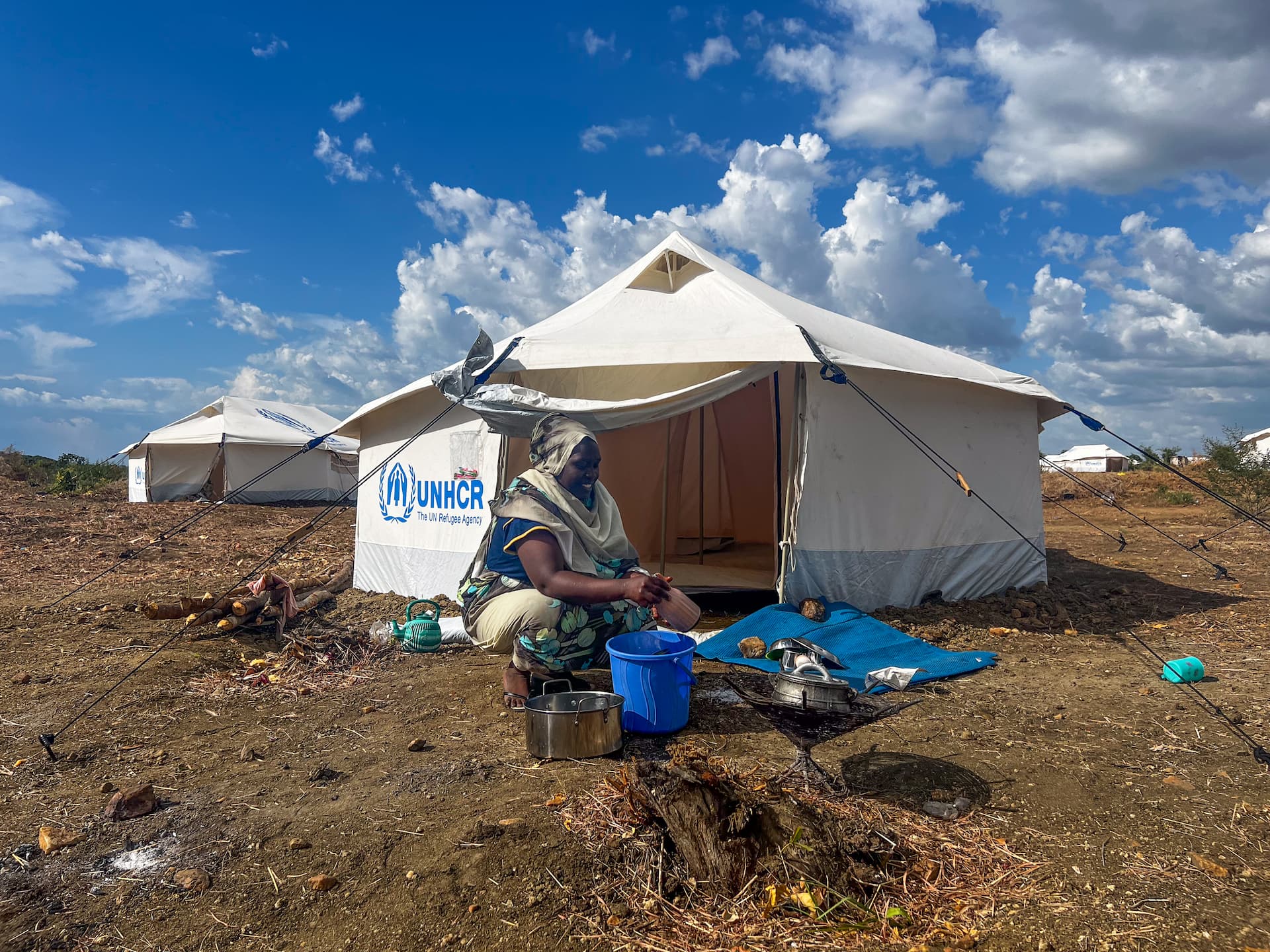
South Sudan. A refugee from Sudan who recently arrived in Gorom refugee camp. © UNHCR/Charlotte Hallqvist
A household survey provides a detailed snapshot of living conditions and is vital for informing operations, programmes and policy. But in displacement settings, conditions can change faster than high-quality surveys can be repeated, especially as funding tightens. So what happens in the years in between? SocioSat complements survey evidence by providing a more continuous view of where socioeconomic conditions may be shifting. For UNHCR operations and partners, this offers an additional layer of evidence to help focus attention, contextual analysis and field verification between survey rounds.
The blind spot between survey rounds
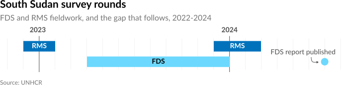
UNHCR’s Forced Displacement Survey (FDS) and Results Monitoring Survey (RMS) provide detailed socioeconomic evidence on the welfare of refugees, internally displaced people, returnees and host communities. But these surveys are resource-intensive, which limits how often they can be repeated, leaving gaps between rounds precisely when conditions may be shifting. SocioSat explores whether model-based estimates can help fill those gaps, tracking socioeconomic changes over time and space between survey rounds, helping identify where conditions may be shifting and where a closer operational look may be warranted. The modelled socioeconomic index follows the logic of UNHCR’s FDS asset-based wealth index methodology. It captures relative living standards by combining information on household assets, housing quality, and access to basic services into a single score, with higher values indicating relatively better socioeconomic conditions.
Harnessing existing innovation for displacement settings
Satellite-based models are increasingly used to complement household surveys where direct observations are limited, drawing on physical and economic signals visible in settlements and their surroundings. Landsat imagery captures patterns in vegetation, water, land cover and the built environment. Night-time lights add information on electrification and economic activity, while building data reflects settlement density and structure. SocioSat combines these signals over time with survey measures to generate timely estimates that complement direct survey evidence.
These models have largely been developed for general populations in non-displacement settings, and FDS and RMS provide the displacement-specific evidence needed to adapt them. But even with recent progress, too few surveys exist in displacement settings to train a complex model from scratch. SocioSat therefore uses transfer learning: a model first learns useful patterns from a large dataset (the Demographic and Health Surveys) and then adapts that knowledge to a smaller, related one (FDS + RMS).
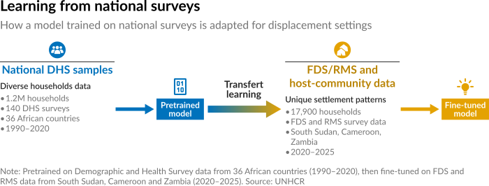
The empirical results across South Sudan, Cameroon and Zambia are encouraging. The adapted model captures meaningful spatial variation in socioeconomic conditions, with particularly promising results in camp and camp-adjacent environments. The accompanying paper provides detailed validation results and limitations.
Keeping up with socioeconomic change
Once adapted, the model can be rerun on new imagery to produce repeated estimates for the same places. In South Sudan, the 2023 FDS provides a survey baseline, and imagery from 2024, and 2025 extends the picture beyond the survey year. The analysis covers all locations within the Admin-3 levels where FDS and RMS data were collected, including formal camp areas, refugees living outside camps, and surrounding host communities. The results therefore represent the FDS- and RMS-covered displacement-affected areas (not the entire country). This offers continuity between survey rounds, flagging where conditions may be shifting and where a closer look is warranted. Together, these updates show both how conditions have moved over recent years and where they stand today.

Between 2023 and 2025, the modelled socioeconomic index for South Sudan fell by 27% — a 5.9-point drop from the 2023 baseline — with conditions declining across almost every mapped area. The index follows the logic of the FDS socioeconomic-index methodology, and the decline builds year on year: 12% in the first year, 27% cumulatively by 2025. Importantly, the estimates signal where socioeconomic conditions may be changing; they do not directly observe household-level change and should be read alongside survey findings, contextual evidence and field verification.

From model to operational insight
SocioSat, which is supported by the World Bank UNHCR Joint Data Center, is designed to deliver regularly updated estimates — at annual or semi-annual intervals — as new Earth observation data become available, extending socioeconomic evidence from one survey round to the next. Household surveys remain the primary reference, but constrained humanitarian funding limits how often large-scale surveys can be run. Satellite-based estimates help fill that gap, flagging where and when conditions may be shifting so that attention and field verification can focus where they are most needed. The longer-term ambition is to offer this as an iterative service for UNHCR operations and partners: identifying priority periods and areas, generating updated evidence, and delivering results through accessible maps and briefs.
and the accompanying paper.